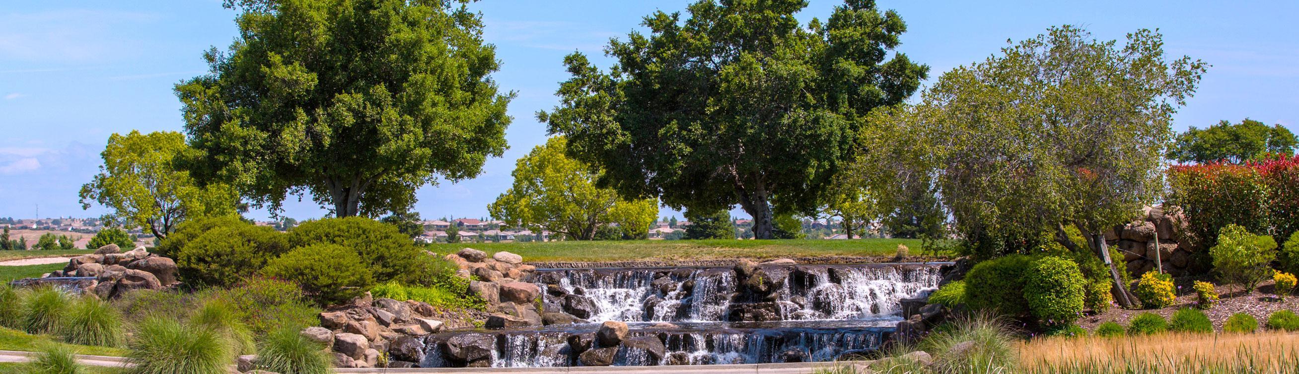
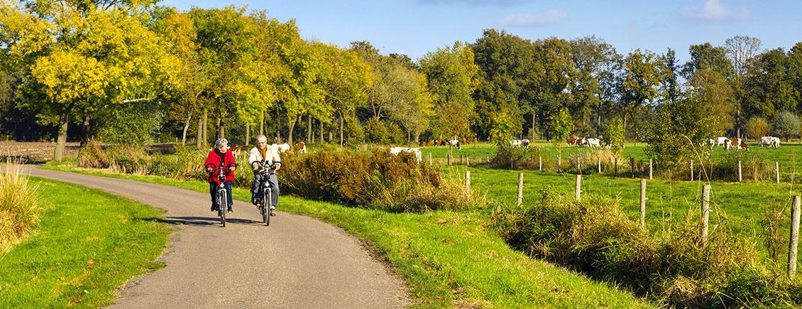
Surrounded by 500 acres of open space and preserved wetlands, riparian, and oak-woodlands, Sun City Lincoln Hills Community Association takes stewardship of the land seriously. We work hand-in-hand with the Wildlife Heritage Foundation, Placer County Agricultural Department, State Department of Fish and Game, and U.S. Corps of Engineers to protect and preserve the 500 acres of open space and the wildlife that inhabit the land. Del Webb created an endowment to ensure this conservation is perpetuated. You can go to http://wildlifeheritage.org for more information.
The 27 miles of Fitness Trails offer residents and their guests various levels of activity and scenery. Read below that outlines the different trails and gives descriptions of the trail features, distance, and level of difficulty.
DEL WEBB BOULEVARD TRAIL
Explore the community with this long and challenging sidewalk trail. Either direction offers long sloping downhill and equally matching uphill stretches with a moderate to difficult challenge. Approximate distance 4.0 miles.
ORCHARD CREEK TRAIL
A moderate open space and sidewalk trail when taken in either direction. Walk along the Hills Golf Course, Orchard Creek & Leavell Park. Please be aware, golfers/golf carts share the trail just south of the driving range & 1st and 9th fairways. Approximate distance 2.0 miles.
SPORTS PLAZA TRAIL
This trail travels through the Sports Plaza, Village 14 and open spaces which are ideal for viewing wildlife. Visit the interpretive sign and grinding hole site at the Sports Plaza to learn about the Nisenan. This trail is relatively flat with the exception of the steep slope connecting the Sports Plaza to Village 14. Be aware, the connecting path is shared with carts. Not ADA accessible. Approximate distance 1.0 mile.
LEAVELL RANCH TRAIL
This trail covers land that was once part of the Leavell Ranch. You will also stroll through Villages 29 & 30. Each direction provides lengthy descents and corresponding ascents with a moderate challenge. Visit the interpretive sign along the Orchard Creek Preserve to learn about the Leavell family of Lincoln. Approximate distance 2.0 miles.
WETLANDS TRAIL
This trail adjoins the Ingram Slough wetlands and the Orchard Golf Course. Both directions provide uphill stretches with a moderate challenge. The wetlands are excellent for wildlife viewing and you may also notice Ba Mu Ma, the salt spring used by Native Americans to gather salt. Visit the interpretive sign and learn more about the Ingram Slough. Not ADA accessible. Approximate distance 1.0 mile.
NORTHEAST PRESERVE TRAIL
This moderate trail extends along the Northeast Preserve and Village 19. The trail follows gentle upward and downward slopes with an easy to moderate challenge. Follow this branch of Ingram Slough to the pond or continue along Ingram Slough to the Canyon Oaks Trail. Approximate distance 1.5 miles.
CANYON OAKS TRAIL
This moderate trail gently meanders along Ingram Slough and through Villages 22A/B. Visit the interpretive sign to test your oak tree identification abilities. Within the canyon, a bridge leads to the Elderberry Trail. On the sidewalk trail, you will pass the neighborhood park of Village 22B, perfect for a respite. This pathway includes decomposed granite and cement paths, and sidewalks. Not ADA accessible. Approximate distance 2.0 miles.
ELDERBERRY TRAIL
This moderate trail descends into the Northeast Preserve and then ascends into Village 21. Visit the interpretive sign and learn about the federally protected Valley Elderberry Longhorn Beetle. You can also cross the woodland bridge and walk the Canyon Oaks Trail. This trail includes decomposed granite and cement paths, and sidewalks. Not ADA accessible. Approximate distance 1.0 mile.
FOUNTAIN HILL TRAIL
This moderate to moderately challenging trail follows Orchard Creek (North Branch) and passes through Village 23. Eureka! Did you find it, the interpretive sign? This trail's sign shares information about the search for gold in Lincoln. During the months of February through July, look for nesting raptors in the cottonwood trees adjacent to the creek. Cross the bridge to the Kingfisher Trail. Not ADA accessible. Approximate distance 1.0 mile.
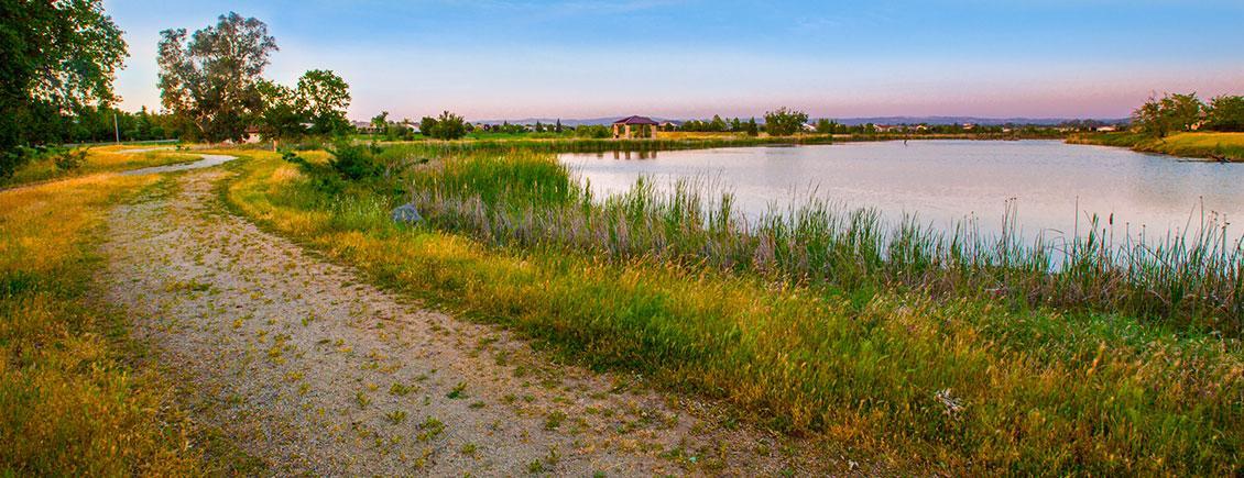
FERRARI POND TRAIL
Walk along the pond and open space, visit our salt spring and see Angler's Cove along the way. Visit the interpretive signs to learn about Angler's Cove's fishing habitat, the seasonal & resident wildlife at the pond, the history of the Ferrari family and the salt spring. This pathway includes decomposed granite and cement paths, and sidewalks. Not ADA accessible. Approximate distance 3.0 miles.
STONECREST TRAIL
Initially, this is a gentle trail behind homes with covered seating available on Parkside Drive. The trail becomes increasingly elevated in the open space as it reaches the Seep Trail connection. Approximate distance 1.0 mile.
FERRARI RANCH TRAIL
An easy, level cement path and sidewalk trail behind homes in Villages 1B and 43B. Stop at the Kilaga Springs Café for refreshments when you are done. ADA accessible. Approximate distance 1.0 mile.
SEEP TRAIL
A descent into the Seep Preserve in either direction with challenging, sustained grade changes. Interpretive signs provide background on seep formations and the comparison of valley and foothill climates. Bench seating in a personal park provides a refreshing stop on Longspur Loop. Not ADA accessible. Approximate distance 1.0 mile.
ORCHARD CREEK NORTH TRAIL
Located within the open space habitat of the Orchard Creek Preserve (North Branch). A personal park midway through the trail offers a relaxing break. Cross Spring Valley Parkway to connect with the Fountain Hill Trail. Approximate distance 1.0 mile.
ORCHARD CREEK SOUTH TRAIL
This moderate cement path and sidewalk trail crosses the Orchard Creek Preserve (South Branch) with golf course views. Be aware, when entering the open space from Carnelian Court, you share the path with golf carts. Cross Ridge Top Lane to connect with the Mallard Pond Trail. Approximate distance 1.0 mile.
KINGFISHER TRAIL
A dramatic, steep stairway leads to a level cement path and sidewalk trail in Villages 24C/D. From Blue Heron Loop, cross the personal park and follow the trail into the open space to meet the Fountain Hill Trail. Not ADA accessible. Approximate distance 1.5 miles.
SPRING VALLEY TRAIL
A short trail descends a severe slope within open space; a second path extends into the concave depression of the hillside. Rest while reading the interpretive sign sharing J. Parker Whitney's progressive vision for Placer County. Not ADA accessible. Approximate distance 0.5 mile.
MALLARD POND TRAIL
Enjoy open space, a serene pond, golf course views and an interpretive sign sharing Lincoln's economic beginnings. Three entry points offer variety to this trail. Approximate distance 0.5 mile.

The Association is committed to decreasing its carbon footprint by following a rigid recycling program and by using solar panels to power energy-efficient lighting throughout the facilities.
Lincoln Hills played a significant role in the city of Lincoln’s cutting-edge Neighborhood Electric Vehicle (NEV) Transportation Plan, which links Lincoln neighborhoods through electric vehicle lanes and routes. It has become a model for cities nationwide in terms of green transportation solutions.
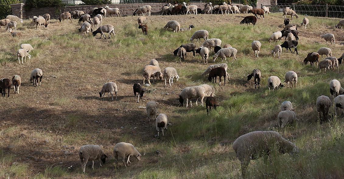
Sun City Lincoln Hills Community Association was at the leading edge of using sheep and goats as a non-chemical method of fire prevention. The sheep and goats munch their way through the extensive amount of grass and undergrowth to prepare 70 acres of fire break throughout the community.
